
Diving Services Inc. provides high quality surveys under the direction of licensed professionals. We have the ability to merge all land-based and off-shore survey data into one complete package, offering our clients a versatile and specific solution for any project with superior value.
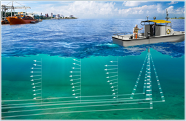
Hydrographic Survey
Our hydrographic surveying services include:
- River and Ship Channel Surveys
- Environmental Surveys
- Lake and Reservoir Surveys
- Condition, Pre-Dredge, and Post-Dredge surveys
- Volume calculations
- Sedimentation
- Erosion sites
- Marinas and harbors
- Monitoring
DSI can provide our clients with professional hydrographic surveys for a variety of needs such as pre and post dredge surveys, reservoir volumetric surveys, pipeline and cable work, bridge scour studies and more.
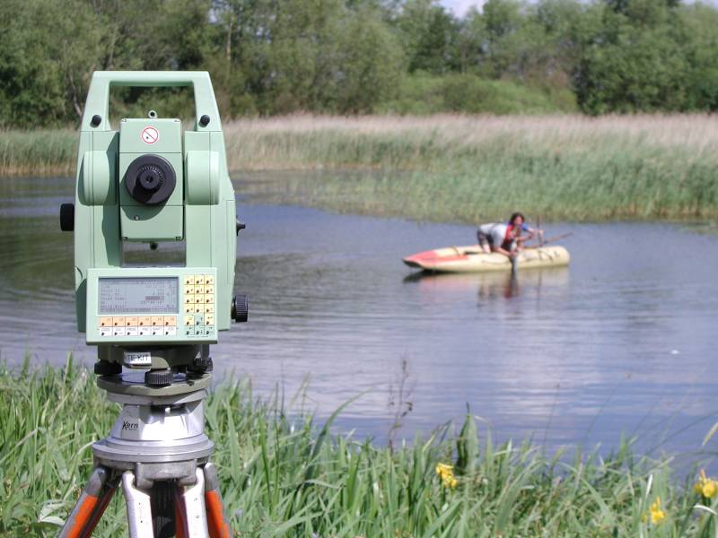
We utilize a Differential Global Positioning System (DGPS) with interfaced hydrographic software to accurately survey your site. All DGPS positioning is available with sub-meter accuracy. Depth readings are obtained by the use of an echo sounder to measure the waters depth and bottom type.
We can also provide you with sub-bottom profiling. All information is downloaded to a computer and available in a variety of formats for a professional quality data presentation.
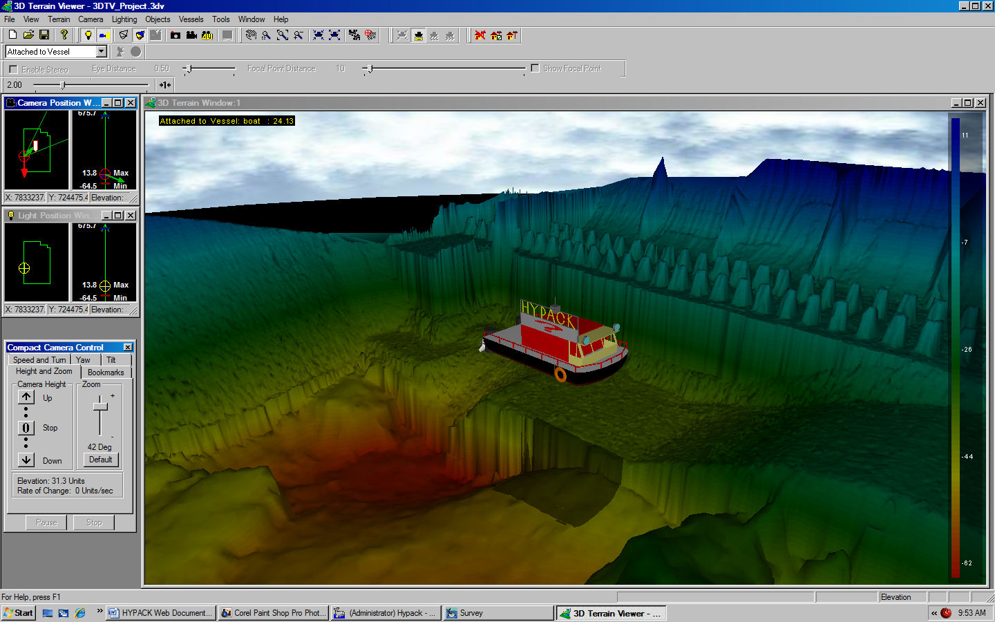
Our 3D Modeling software provides us with the ability to meet the requirements of almost any survey. Once we collect the field data we can apply corrections to soundings, remove outliers, plot field sheets, export data to CAD, compute volume quantities, generate contours, create side scan mosaics and create/modify electronic charts. The majority of our projects are done for engineering firms and general contractors specializing in underwater inspection and repair of bridges dams or water ways. We use state-of-the-art, industry-recommended equipment and software to complete our projects. Drafting can be customized to meet your own standards.
We perform many types of underwater surveys for both the public and private sectors, including the commercial, industrial, and municipal markets. We use state-of-the-art equipment to provide complete and accurate final plans that are easy to work with - making our clients' jobs as easy as possible.
